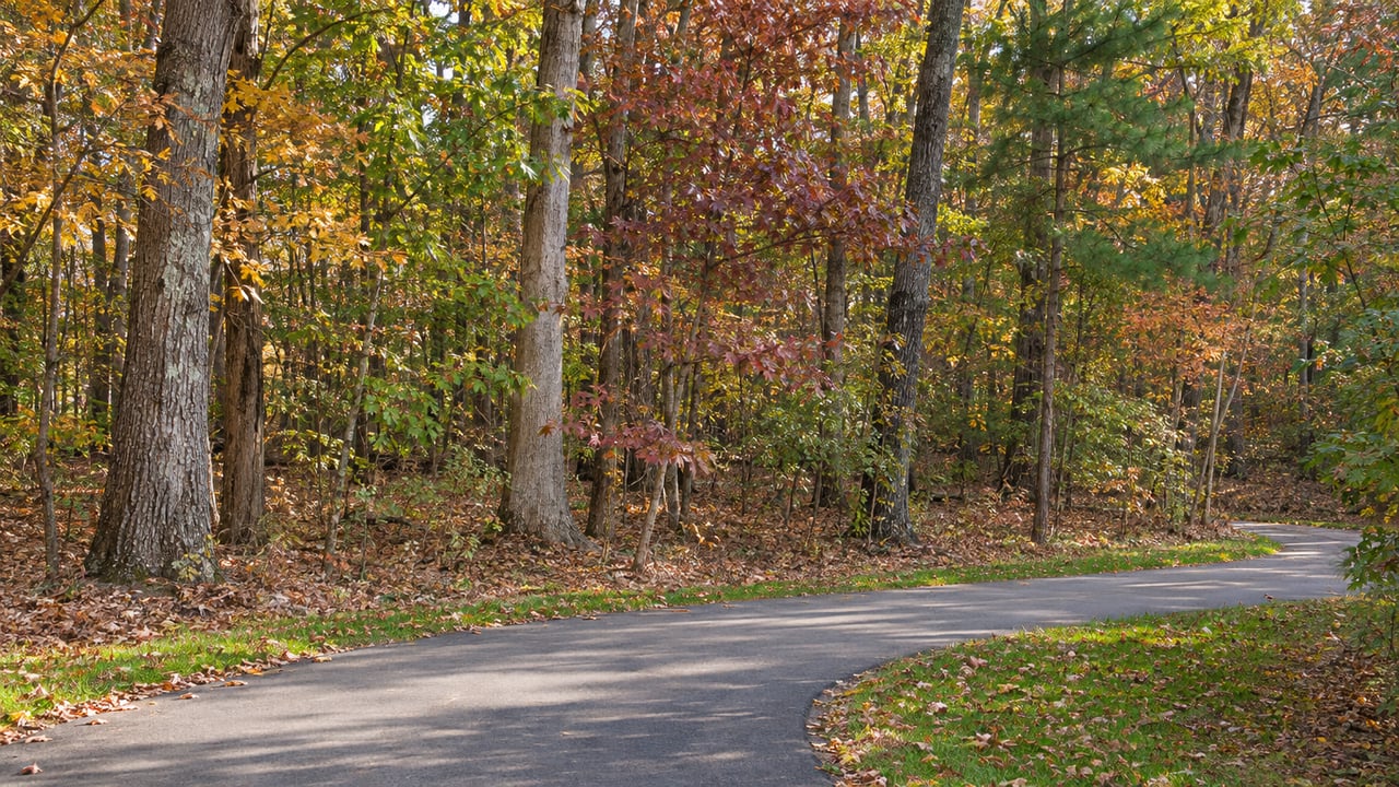
Foundation Drive ends at a small parking area near Heritage High School. From there the paved Smith Creek Greenway heads behind the school toward Sanford Creek. On one side of the asphalt is a stretch of woods that people in this part of Wake Forest have called "Shady 80" for years. Since June 19, "No Trespassing" signs have stood along the edge of those woods.
On October 20, the land got a new name. The Wake Forest Board of Commissioners voted unanimously to call the 80-acre tract at 0 Old Crawford Road "Heritage Nature Preserve." The town bought these woods 21 years ago for public walking trails and picnic areas, and the name is its first formal step toward that use.
A name approved before any opening
The staff memo behind the October 20 vote lays out the order. In the four months after the signs went up, staff completed several site assessments. They also had an internal consultant do an independent assessment, and they talked with the North Carolina Department of Environmental Quality and the NC Land and Water Fund management office. The memo states the goal as "to open the property in the future for the intended purpose of passive recreational use with established, set guidelines and parameters to ensure safe and heathy use of the property." It then says, "The first step in this process is to establish an official name for the property."
The resolution took effect when it was adopted. It tells town departments to update records, maps and signs to the new name. The trail itself is a separate matter. The town's web page for the Heritage High Soft Trail, the dirt path that winds through the tract, still says "This Trail is permanently closed." As of this fall, then, the woods have an official name and a stated goal of opening, and the old informal trail through them stays closed.
What the 2005 purchase was meant to become
The "intended purpose" in the memo goes back to the purchase. Wake Forest Matters traced the paper trail in June. According to its reporting, The Trust for Public Land, a national land-conservation nonprofit, transferred the 80.45-acre tract to the town in September 2005 for $2,232,500. The Trust had bought the land in 2004 from two local families. A Wake County Open Space grant committed up to $1,116,243.75 toward the price, which is about half.
The same reporting describes the land itself. About 69.56 acres are woodland and 10.89 acres are Smith Creek floodplain. The parcel is zoned Open Space, has no buildings, and has been tax-exempt since 2006. Wake County's 2024 revaluation assessed it at $2,568,302.
The grant agreement spells out what passive recreation meant for this land. Wake Forest Matters quoted the approved uses from section 6.3(b):
"picnic sites (formal and informal), formal walking and jogging trails, informal Open Play areas, comfort station and parking."
That list describes a neighborhood park built around walking, with trails, picnic spots, a restroom building and a parking lot. None of it was built. The town held public input meetings in 2018 with the aim of writing a master plan. Communications & Public Affairs Director Bill Crabtree told the outlet the town "chose not to proceed" once it learned the property could only be used for passive recreation. Over the years that followed, informal trails took shape in the woods.
Why the signs went up in June
The informal trails are why Shady 80 is closed now. In its June 19 announcement, the town said officials had found "well over 60" electric bikes on the property on at least one occasion, along with jumps "some as tall as six feet." It also cited the "flagrant destruction of several trees and vegetation." The town called that damage a violation of the 2005 grant agreement, which requires the land to be kept as open space and used mainly for passive recreation.
Public Works crews removed the jumps in late May and early June, and police added patrols. The signs that went up June 19 closed the tract to all unauthorized use, "including biking, walking, hiking, motorized/electric bike use, and use of any unapproved dirt-jump features." The town has also said that over the years, crews put up no-trespassing signs "on numerous occasions, only to have the signs removed or destroyed."
That is why walkers lost access along with riders. In Wake Forest Matters' June 17 story on the closure, the woods were described as unofficial trails used by mountain bikers, hikers and walkers. In the outlet's follow-up, one resident said she had hiked the tract with her dog for more than nine years. Crabtree said in writing that the land "was never open for public use" and pointed to liability: "Should someone get hurt jumping their bike on earthen ramps as high as six feet tall, the Town would be legally responsible." He added that erosion made it impractical to close "just the damaged spots." At that point officers had given seven verbal warnings and no citations.
"Opening, not reopening"
Wake Forest Matters reported that Parks, Recreation & Cultural Resources Director Ruben Wall had written in an email that the town would consider opening the property for passive recreation once the damage was assessed and dealt with. He was specific that the word was "opening (not reopening)."
That fits the town's position that Shady 80 was never an official public space. It also explains the next steps. The town is not restoring a trail it once ran. If Heritage Nature Preserve opens, it will open with access the town has designed, under the "established, set guidelines and parameters" in the memo. Talks with state environmental and land-conservation offices are part of setting those terms. In June, Crabtree said there was no "specific timeline" for public access. The October memo states opening as a goal and lists naming as its first step.
The public route past the preserve today
The closure does not cover the paved path. The town's June statement calls the Smith Creek/Sanford Creek Greenway its designated public greenway in this area and says it "remains open for public use in accordance with posted rules and regulations." Wake Forest Matters also noted that the paved greenway runs alongside Shady 80.
The town lists these places to get on the greenway from the Heritage side:
- Smith Creek Soccer Center, 690 Heritage Lake Road. The Smith Creek Greenway page lists parking here. The 10-foot paved path runs past the schools and connects behind Heritage High to the Sanford Creek Greenway.
- The end of Foundation Drive, near Heritage High School. The town lists parking here too. It is the closest of the four entry points to the preserve's edge.
- Sanford Creek Avenue cul-de-sac. The Sanford Creek at Heritage South page lists parking here.
- The end of Marshall Farm Road. This is where the Sanford Creek trail starts. Neighbors can also walk on from Marshall Farm Street, Sanford Creek Avenue and Fawn Lily Drive.
Where the greenway goes next
The paved path along the preserve is also the end point of the town's next big greenway project. The town's Smith Creek Greenway project page describes Phases 2 and 3 as 2.5 miles of 10-foot-wide paved trail. It would start at Burlington Mills Road and connect to the existing Smith Creek and Sanford Creek Greenways near Heritage High School.
Funding moved forward this fall. Here is what has been approved or requested:
| Funding step | Date | Amount |
|---|---|---|
| NCDOT municipal agreement, project BL-0188 | Approved by Board of Transportation, Oct. 8, 2026 | $20,532,893 total available |
| Federal reimbursement share | Same agreement | Up to $5,338,552, 26% |
| Town's non-federal match | Same agreement | $15,194,341, 74% |
| Local Land and Water Conservation Fund application | Authorized by commissioners, Oct. 20, 2026 | $750,000 requested, $750,000 local match |
Wake Forest commissioners approved the NCDOT construction-funding agreement on September 15. The town packet says any LWCF award would go back to the board for approval. The NCDOT agreement describes the project as running "to the existing greenway at Heritage High School." So the paved edge of Heritage Nature Preserve is set to become one end of a longer route heading south toward Burlington Mills Road.
Bike riders have a dedicated facility planned across town. The town says it is designing Wake Forest's first skate park and pump track on 8.3 acres at 701 Harris Avenue, next to Devon Square and E. Carroll Joyner Park. Plans include a pump track, basketball courts, an outdoor fitness court, a pavilion, restrooms, parking and lighting. Wake Forest Matters reported in June that the board had accepted more than $4 million in hospitality-tax funding toward the project. If both plans move ahead, pump-track riding would have a home on Harris Avenue, and the woods behind Heritage High would serve the walking-and-picnic use described in the 2005 grant.
Our team at Carolina Elite Realty Group lives and works in Wake Forest, and we follow projects like Heritage Nature Preserve and the Smith Creek Greenway because they shape everyday life around Heritage. If you'd like to know how the greenway plans might affect a specific street or property, reach out to schedule your consultation. We're glad to walk through what's planned nearby.